





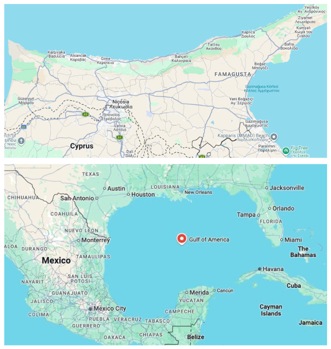
On his first day back in the White House, Donald Trump signed an executive order renaming the Gulf of Mexico the Gulf of America, while restoring the name Mount McKinley to the peak Alaskans have called Denali since 1975. "We will be restoring the name of a great president, William McKinley, to Mount McKinley, where it belongs," he said at his inauguration.
The decision carries no force beyond American borders. Mexico continues to use its own name for the gulf, and most international mapping bodies have not adopted the change. Similar discussions touched even Lake Ontario, before the US administration later considered a comparable move on the Persian Gulf ahead of a visit to Saudi Arabia, informally floating the name "Arabian Gulf." The proposal drew a sharp response from Iran's foreign ministry, which called it "indicative of hostile intent toward Iran and its people."
Both cases rest on the same logic: that a state's power to rename a place is sufficient to impose the new toponym, regardless of whether other countries or populations recognise it. This is a phenomenon with a long history.
Geographers working in the field known as critical toponymy, among them Maoz Azaryahu, Derek Alderman and Reuben Rose-Redwood, argue that toponyms function as instruments for exercising political power over space, history and collective memory. The relevant literature includes examples from Romania, South Africa, New Zealand and the American South, treating the renaming of toponyms as a recurring feature of regime change and the pursuit of territorial control.
A story spanning centuries
The most characteristic case of systematic state toponym-renaming policy is Israel's. In July 1949, David Ben-Gurion established a Government Naming Committee tasked with assigning Hebrew toponyms, first to the Negev desert and then to the entire newly founded state. The criteria adopted gave priority to biblical and historical Hebrew references over existing Arabic toponyms.
Ben-Gurion's instruction to the committee is recorded as follows: "We are obliged to remove the Arabic names for reasons of state."
Later research, including Walid Khalidi's work All That Remains, shows that villages where the Arab population remained after the 1948 war largely kept their traditional toponyms. Most renaming, by contrast, concerned areas whose residents had abandoned or been forced to abandon their homes.
Ireland offers a further example, in this case concerning the extensive anglicisation of Gaelic toponyms. The process began in the medieval period and was largely completed through 19th-century cartographic standardisation. In many cases, the new forms lost all connection to the original meaning of the toponyms: Cluain Meala, meaning "meadow of honey," ended up appearing on maps as Clonmel.
Ireland's Placenames Commission was established in 1946, and specific legislation in 1973 was needed before restored Irish toponyms acquired full legal standing in official use.
Crimea is another characteristic case. Following the deportation of the Crimean Tatars in 1944, Soviet authorities renamed more than 1,300 settlements, replacing centuries-old toponyms with standardised Soviet ones. In 2016, Ukraine's parliament approved a resolution restoring the historic toponyms of 70 settlements and five administrative districts, invoking the rights of the Tatars as an indigenous population. The resolution's implementation is set to take effect once the peninsula returns to Ukrainian administration.
The Cyprus case
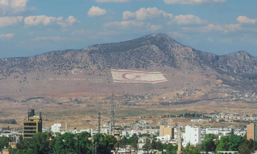
The Cyprus Permanent Committee for the Standardization of Geographical Names, which has represented the Republic of Cyprus at the relevant United Nations conferences since 1967, documents a comparable process that began after 1974.
According to the committee's records, the authorities in the occupied areas systematically replaced Greek toponyms. The process was not confined to Greek Cypriot villages but extended to Turkish Cypriot settlements as well. Sinta was renamed İnönü, while Ortaköy became Menteşeköy.
The Republic of Cyprus also responded at the institutional level. Law 71(I)/2013 makes it a criminal offence to alter the officially standardised toponyms of the Republic of Cyprus, as well as to produce or distribute maps and documents using different names.
Academic research offers a more complex picture of how this policy was implemented in the occupied areas. In her book The Make-Believe Space: Affective Geography in a Postwar Polity, based on fieldwork conducted between 1998 and 2003, anthropologist Yael Navaro-Yashin records that all pre-existing toponyms were abolished without exception, including traditional Turkish Cypriot ones.
In the book's introduction, the then head of the relevant mapping authority in the occupied areas is described as presenting the renaming as part of the process of establishing political sovereignty over the territory.
Interviews with Turkish Cypriots included in the book outline a society that continued to perceive a persistent "Greek presence" in the landscape, through abandoned churches, ruined cemeteries and empty villages. The research also records tensions between longer-established Turkish Cypriots and more recent settlers from Turkey. Some of the latter, according to the author, even self-identified as "the last of the Mohicans."
The same study also notes the ambivalence of many Turkish Cypriots toward obtaining a Republic of Cyprus passport, despite remaining entitled to one under Cypriot law.
On the other side of the dividing line, studies of displaced Greek Cypriots record a comparable relationship with place. Research across generations of refugees shows that the old toponyms and their symbolism continue to be preserved even by second and third generations who have never visited their ancestral homes. The international literature records a common pattern among displaced communities regarding local identity and the memory of place.
The open question
The most specific example of how the issue of toponyms might be addressed within a comprehensive settlement remains the 2004 Annan Plan, rejected by 76 percent of Greek Cypriot voters.
A letter from the Cyprus Permanent Committee for the Standardization of Geographical Names to then UN Secretary-General Kofi Annan, dated 11 December 2002, records that the plan's text and accompanying maps systematically used dual toponyms for locations on the island. Greek and Turkish names appeared side by side, as in the cases of Rizokarpaso/Dipkarpaz and Aigialousa/Yeni Erenköy.
The committee's objection was not to the use of dual toponyms as such. It centred, rather, on the specific Turkish forms chosen. According to its position, these were toponyms imposed after 1974, not the traditional Turkish Cypriot names used before the invasion, which, it maintains, the Republic of Cyprus continues to preserve in its official records.
This position was grounded in a 1977 resolution of the United Nations Conference on the Standardization of Geographical Names, which recommends that toponym changes imposed by authorities other than a state's recognised national body should not be recognised.
Tomorrow's name
More than fifty years after the island's division, a seemingly technical issue remains unresolved. How Cyprus will be represented on any future common map remains unanswered. And while the question may appear secondary next to the chapters on security, territory or governance, the experience of other conflicts shows that toponyms are systematically used by states and political authorities as instruments of symbolic sovereignty, the shaping of collective memory, and the legitimisation of territorial claims.


