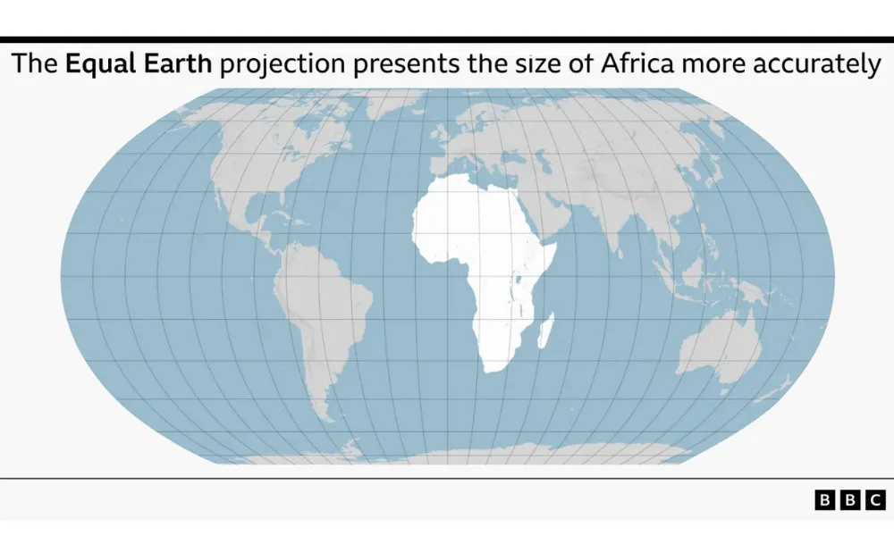
The UN General Assembly has voted to encourage governments, schools and technology companies worldwide to move away from the traditional Mercator projection, backing a resolution that promotes maps showing the true relative size of continents, particularly Africa. The "Correct the Map" resolution passed on Friday by 164 votes to one, with the United States the sole vote against and six countries — Estonia, Georgia, Lithuania, Moldova, Serbia and Ukraine— abstaining. The vote is non-binding, but is expected to influence the maps used by institutions globally.
There is a recognisable pattern in how nations, like people, are seen and measured: how a place presents itself, how it is depicted by others, how it believes it is perceived, and how it actually measures up. This week's vote touched on all four.
How Africa presents itself
The campaign was led by Togo, on behalf of the African Union, whose 54 member states had already adopted the alternative Equal Earth projection in February, describing it as a more accurate representation of the continent's true scale. Togolese Foreign Minister Robert Dussey told the UN that maps "guide education, nourish the imagination, and influence collective perceptions," framing the resolution as "African reality" reaffirmed. Advocacy groups, including Africa No Filter, campaigned alongside the AU, arguing that the continent's cartographic diminishment functions as a narrative problem rather than a simple technical error.
How the world has long depicted Africa
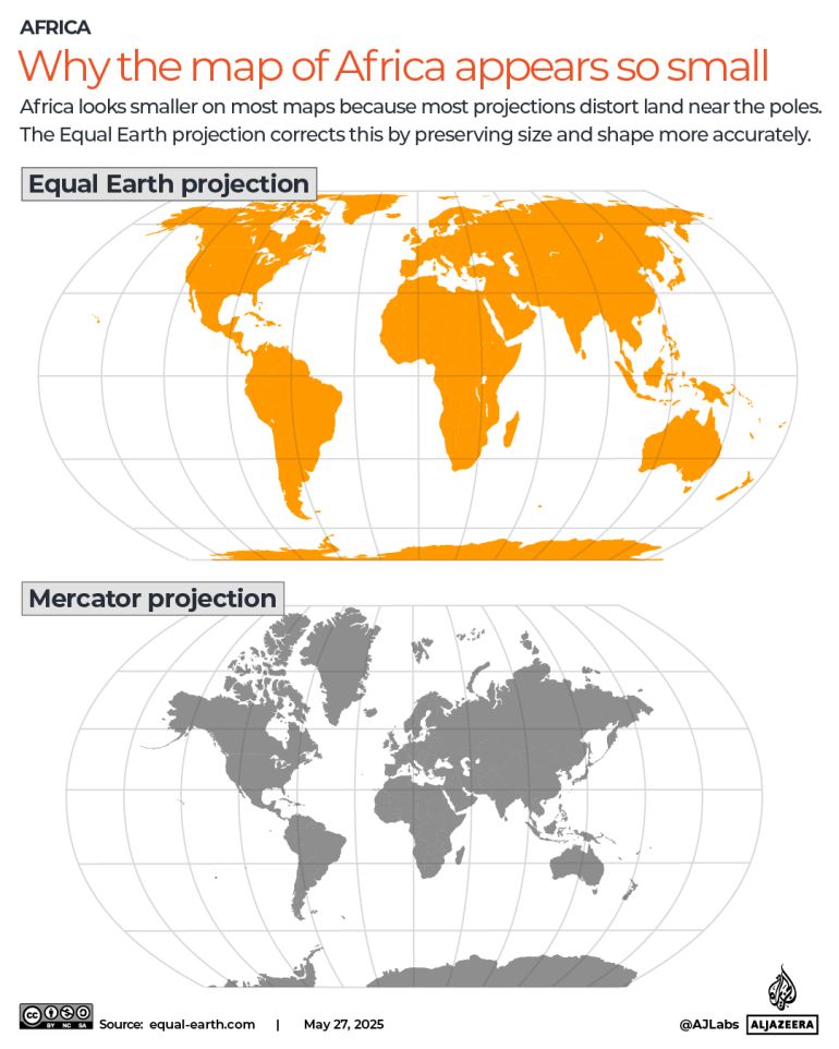
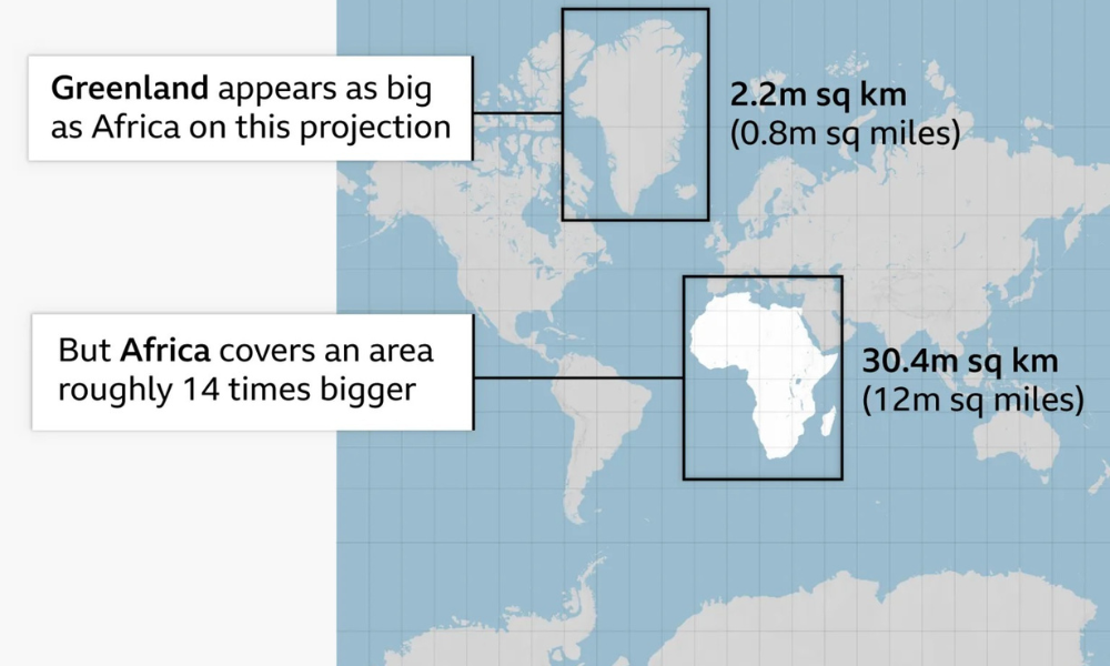
The Mercator projection, devised in 1569 by Flemish cartographer Gerardus Mercator to aid maritime navigation, preserves compass directions at the cost of accurate area. Landmasses further from the Equator appear larger, while those nearer it, including Africa, appear smaller. As a result, Greenland, at roughly 2.2 million square kilometres, appears comparable in size to Africa's actual 30.3 million square kilometres — nearly 14 times larger in reality. Africa is large enough to contain the United States, China, India and most of Europe combined, yet has appeared on conventional maps as similar in scale to a single Arctic island.
How the shift is being received
Reactions to the resolution have been split. France, which co-sponsored the measure, announced it would abandon the Mercator projection for official use. Foreign Minister Jean-Noël Barrot said the traditional map gives "disproportionate visual prominence" to powers such as the United States, Russia and China compared with Africa, Latin America or Southeast Asia. The United States, by contrast, rejected the resolution as part of a wider "ideological project," with its representative, Yaryna Ferencevych, arguing the debate distracted from"genuine problems of international peace, prosperity, or good relations." Ukraine, while backing efforts to correct historical distortions affecting the Global South, abstained over concern that Equal Earth-style maps could create ambiguity around Russian-occupied Ukrainian territory, warning against opening a "Pandora's box" on disputed borders. The European Union, represented by Ireland, supported the resolution but stressed it had no bearing on sovereignty, territorial status or internationally recognised borders.
How the continents actually compare
Under the Equal Earth projection, developed in 2018 by cartographers Bojan Savric, Tom Patterson and Bernhard Jenny, the real scale becomes clear. Africa covers approximately 30.3 million square kilometres. Latin America spans roughly 20 million square kilometres, of which South America accounts for 17.8 million. Oceania covers about 8.5 million square kilometres, almost entirely Australia, while South Asia, the smallest of the four regions, spans 5.1 million square kilometres yet holds close to a quarter of the world's population. Combined, these four regions cover roughly 64 million square kilometres — more than 40% of the world's land surface — compared with Europe's 10.2 million square kilometres.
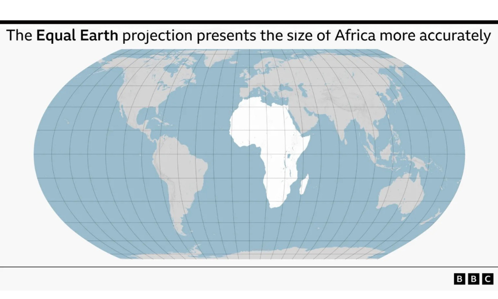
The resolution does not ban the Mercator projection, nor does it impose a single replacement. It encourages the use of equal-area maps where relative size matters, and asks that the limitations of any flat map be taught alongside it. As Dussey put it, the aim is not to alter geography itself but to change how it is seen.
With information from: BBC, Al Jazeera, UN News