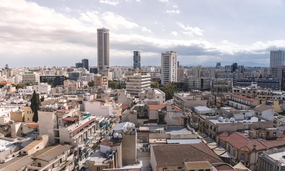

A different Nicosia, more compact, greener, better served by public transport and making greater use of land already located within the urban fabric, emerges from the views expressed by residents during two public consultations on the revision of the capital’s Local Plan.
The proposals collected by the Nicosia municipality do not constitute decisions, nor are they binding on the consultants who will prepare the new plan. They do, however, provide a clear picture of the concerns of those who took part in the process.
Where and how should the city grow? What should happen to large inactive sites? How much space should be given to cars? How can public transport be strengthened? And how can the identity of neighbourhoods be protected?
Interest is focusing on making better use of space that already exists. The discussion does not appear to be moving towards a general expansion of the city, but rather towards a denser and more functional model, with more services and activities located closer to housing and fewer long-distance daily journeys.
These are choices that directly affect the daily lives of Nicosia residents, from the distance to a public service or bus stop to whether a neighbourhood can retain residents, commercial activity and public space without depending almost entirely on private vehicles.
A changing Nicosia
The revision of the Local Plan gains particular significance when considering that the current 2018 Nicosia Local Plan is essentially a republication of the 2012 plan, which was based on data from the period 2001-2010.
Simply put, a large part of today’s planning framework is based on data from a different Nicosia.
Over the intervening years, the city has changed. Its population has shifted, housing numbers have increased and the university presence has expanded significantly, together with demand for student accommodation.
Pressures on the road network have also changed, with traffic congestion becoming a daily headache for residents and authorities alike, while commercial activity and demands for public space, green areas and more efficient mobility have evolved.
Although legislation requires a review of Local Plans every five years, the process currently under way has been delayed.
The geographical scope of the new plan is almost doubling. While the current Local Plan covers 172.7 square kilometres, the revised boundary will extend to 361.2 square kilometres.
The process began in October 2025 and, based on the current timetable, publication of the new Local Plan is expected in early or mid-2028.
Capacity for many more residents
One of the most important issues in the discussion concerns the capacity of existing residential zones.
According to available data, they could theoretically accommodate 349,244 residents, a figure 3.1 times greater than the 111,433 inhabitants recorded in 2021.
This raises a key question: does Nicosia need to continue expanding eastwards or upwards, or, as the figures suggest, is there still considerable space within the city that could be used more effectively?
The average saturation rate of residential zones stands at 75%.
It is estimated at 70% in the Nicosia municipal district, 85% in Agios Dometios, 80% in Engomi and 74% in Aglantzia.
These differences indicate that there is no single picture across the capital and that each area has different opportunities and constraints.
The situation is even tighter in commercial zones, where saturation reaches 94%.
During the consultations, this was linked to the need for greater mixing of uses so that housing, employment, commerce and services are located closer together.
This does not translate into a blanket increase in building density across the city.
The direction that emerged is more targeted: each area should be examined on the basis of its infrastructure, accessibility, land uses and actual capacity to absorb new development.
Just 4% commercial zones
The current distribution of land explains why the debate over urban expansion is not a simple mathematical equation.
Of the approximately 67.1 million square metres within the municipality covered by the current Local Plan, 36% is residential.
Commercial zones account for only 4%, agricultural zones 30%, protection zones 15.5% and public-use zones 6.5%.
The large proportion of agricultural and protected land, combined with the geographical characteristics of the capital, limits the options for continuous outward expansion.
As a result, attention is turning to areas already within the urban fabric that remain sparsely developed, inactive or underutilised.
Beyond Engomi
Data from the past two decades show that Nicosia has not grown at the same pace everywhere.
Between 2001 and 2021, the population of today’s municipality increased by 20%, reaching 111,433 residents.
Engomi recorded the largest increase, at 50%.
It was followed by Nicosia with 18%, Aglandjia with 14% and Agios Dometios with 6%.
Changes in housing have been even greater.
Between 2011 and 2021, the total number of homes increased by 15%, from 50,584 to 57,952.
Permanently occupied homes rose by 21%, while vacant and temporary residences fell by 7%.
Here too, Engomi stands out.
The number of homes increased by 62% within a decade, while permanently occupied dwellings rose by 70%.
The strong university presence in the area significantly affected demand for student accommodation, as well as commercial activity and the character of surrounding neighbourhoods.
More green space, fewer cars
Green space was among the issues most frequently raised during the two consultations.
The discussion was not limited to creating more parks. It also focused on how green areas are integrated into the city and whether public spaces should be treated as essential infrastructure rather than a supplementary component of new developments.
In a capital facing increasingly high temperatures, shade, open spaces and continuity between green areas are taking on greater importance.
Traffic congestion, one of residents’ biggest frustrations, also featured prominently.
Urban sprawl over long distances and at low densities makes the development of frequent and effective public transport more difficult.
By contrast, a more compact city with a greater mix of uses and more activities located close to homes could create better conditions for buses, walking and cycling.
The consultations also addressed issues linked to climate change, natural disasters, civil protection and the safety of developments in environmentally sensitive areas or sites with steep slopes, archaeological remains, special geological characteristics or proximity to nuisance-generating uses.
State fairground and racecourse
Particular interest centres on large areas capable of influencing entire sections of the capital.
At the forefront is the State Fairground site, a large unified area of particular importance to Nicosia.
The racecourse in Agios Dometios, which also carries significant planning weight, was another focus of discussion.
References were also made to the Parisinos area and the vicinity of the University of Nicosia and European University Cyprus, where development in recent years has significantly altered both the housing market and commercial uses.
The consultations also recorded suggestions and concerns regarding the traditional core of Agioi Omologites, the Pedieos river area, Lykavitos and Kallipoleos, Platy Aglandjia, the residential area north of the University of Cyprus, Council of Europe Avenue and the BMH area, the new residential area between SOPAZ and the Aglandjia light industrial zone, the Frederick area, the core of Kaimakli and Omorfita.
Mention of these areas does not mean changes in zoning or development coefficients have been decided.
It means they are under review and will be examined on the basis of the specific characteristics and potential of each area.
Division changes the map
Finally, there is a factor that distinguishes Nicosia from every other Cypriot city: division.
The capital’s development takes place along the ceasefire line and in direct proximity to crossing points with the north.
This reality has influenced the city’s centrality, mobility patterns and expansion potential for decades and remains a significant factor in the traffic equation.
The figures illustrate the scale of the constraint.
Of the 103.5 square kilometres that make up the administrative area of the Municipality of Nicosia, 29.7 square kilometres lie within the Buffer Zone and a further 45 square kilometres are under occupation.
This significantly limits available space and makes the proper use of free urban land even more critical at a time when demand for housing, mobility, green space and new activities continues to grow.
From consultation to planning
The two public consultations were the first step in a process expected to last at least another two years.
The municipality collected views on neighbourhoods, roads, land uses, building heights, green space, infrastructure and areas where participants believe changes are possible.
The material will be handed to consultants, who will compare it with planning data and the city’s constraints before formulating their recommendations.
The views already recorded point to several clear directions: better use of the existing urban fabric, more green space, stronger public transport, less dependence on private cars, redevelopment of large inactive or underutilised sites and greater attention to neighbourhood identity.
What remains uncertain is that citizens’ proposals must first undergo assessment by the consultants, while the subsequent steps required to translate them, where feasible, into specific planning policies are expected to take considerable time.
The consultants’ recommendations, meanwhile, are also advisory rather than binding.