143 of the facilities are privately operated
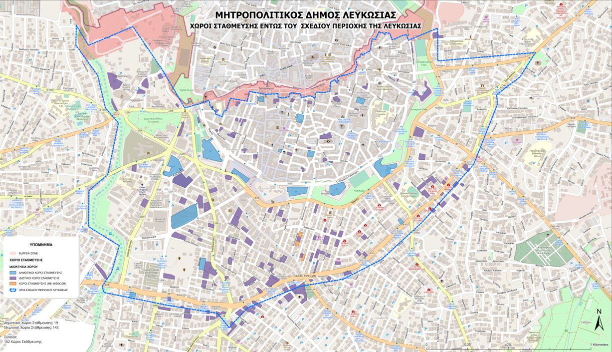
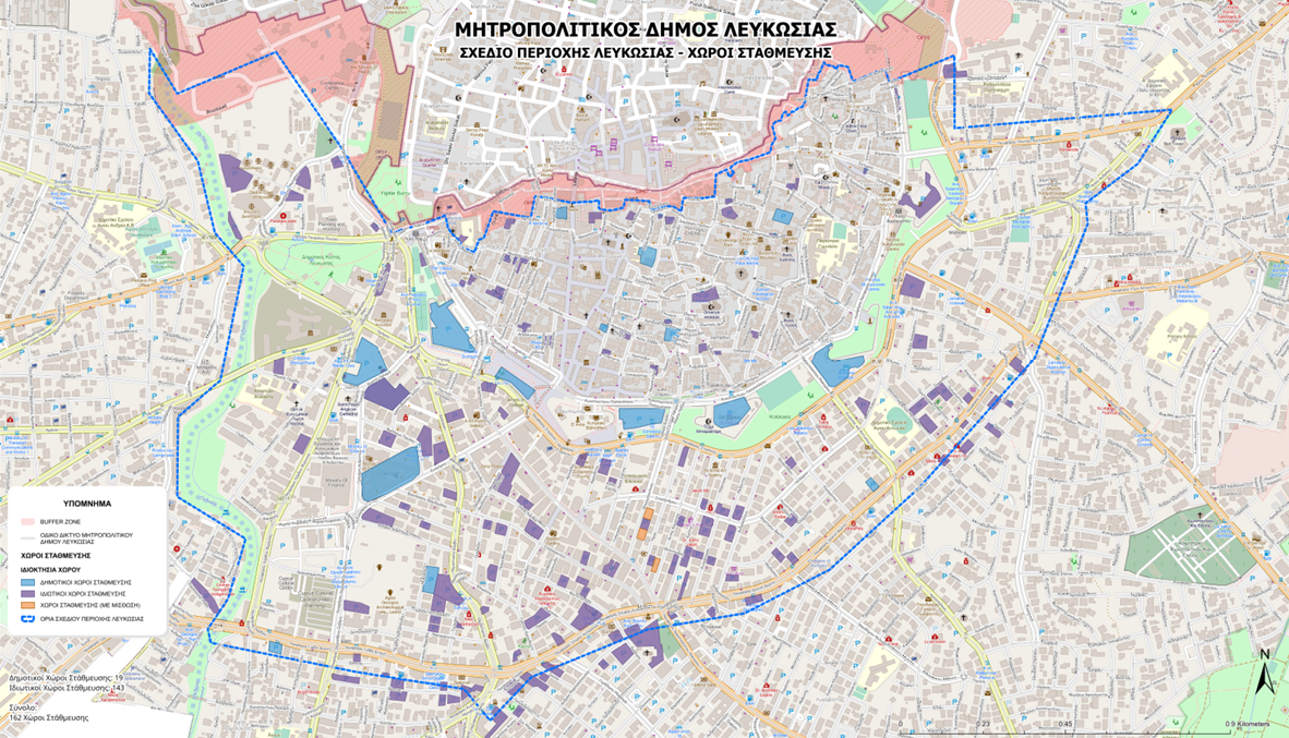
Of the 162 organised parking facilities, 143 are private, accounting for 88.3% of the total.
A further 16 are municipal car parks, while three operate as leased municipal facilities.
The maps show private parking sites spread throughout the Area Plan zone, both inside the Venetian walls and across the commercial and business districts south of the historic centre.
A particularly high concentration is recorded around Makariou Avenue, Stasikratous Street and adjacent roads. Additional organised parking facilities are located near the Venetian walls, entrances to the old city and areas containing offices, shops and other businesses.
Municipal parking facilities are dispersed throughout the city centre, although most recorded facilities remain privately owned.
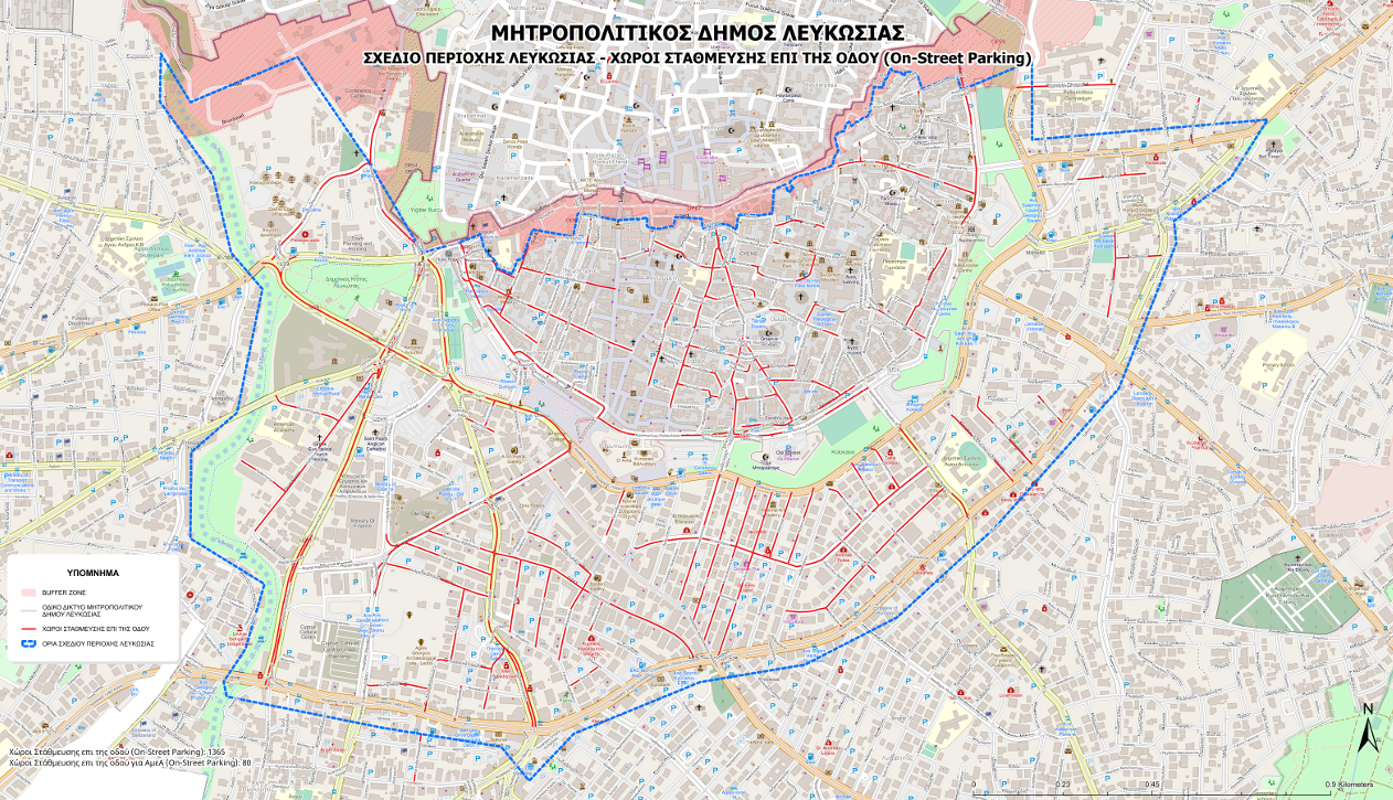
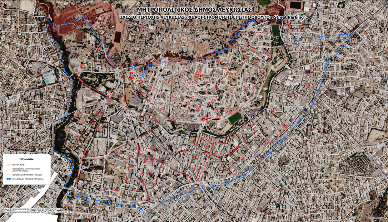
Another 1,484 spaces are located on streets
Separate mapping records parking along the road network.
According to the municipality:
- 1,397 spaces are designated for general parking.
- 87 spaces are reserved for persons with disabilities.
These spaces are distributed across roads within the walled city as well as along routes surrounding the historic centre and areas to the south.
The mapping also identifies sections of road where parking is permitted within commercial districts and mixed-use neighbourhoods containing residences, offices and services.
The 87 disability-designated spaces are counted separately from general parking. As a result, the total number of on-street spaces reaches 1,484.
Importantly, the data do not include information about occupancy levels.
The maps do not indicate:
- How many spaces are available at different times of day.
- How many are occupied by employees.
- How many are used by visitors.
- The average parking duration.
- Vehicle turnover rates.
Focus on the commercial triangle
At the centre of the discussion is the commercial triangle formed by Makariou Avenue, Stasikratous Street and Evagorou Avenue, where major urban regeneration projects and traffic changes have been implemented in recent years.
The maps show organised parking facilities surrounding these commercial streets, while also identifying parking spaces along nearby roads and in other areas of the city centre.
However, the mapping covers the entire Area Plan zone rather than the commercial triangle alone. Consequently, the 162 facilities include parking sites located at varying distances from Makarios Avenue.
The municipal data also do not contain:
- A separate count of spaces within a specific walking radius of Makarios Avenue.
- Walking-distance measurements between parking facilities and key shopping streets.
Depending on location, the facilities serve different parts of the city centre, including the old city, Makariou Avenue and neighbouring commercial and administrative districts.
The Makariou reopening debate
The parking discussion is closely linked to a May 2025 decision by the Nicosia Municipal Council to partially restore access for private vehicles to Makariou Avenue.
The decision, approved by majority vote, would allow private vehicles to use the northern section of the avenue on weekdays between 7am and 9pm.
The existing traffic arrangements would remain in place during weekends and outside those hours.
Implementation has not proceeded because of issues relating to required approvals and obligations connected to European funding received for the urban regeneration project.
The matter has also been discussed in parliament, where possible financial implications of changing traffic arrangements without obtaining the necessary approvals were examined.
Supporters of the reopening argue that allowing private vehicles onto the avenue would improve access for consumers and reduce the need for longer driving routes into the commercial district.
Opponents cite the original urban design objectives, pedestrian mobility and the operation of public transport services.
Access and parking are not the same issue
The debate surrounding Makariou Avenue involves two separate questions:
- Vehicle access through the road network.
- The availability of nearby parking spaces.
The municipal council's decision concerns vehicle circulation along part of the avenue and does not provide for the creation of additional parking facilities.
Likewise, the municipality's mapping records organised car parks and on-street spaces but does not include information about how they are used by visitors to the commercial centre.
The maps do not provide:
- Peak-hour demand measurements.
- Information on private parking charges.
- Studies on consumer travel patterns.
- Estimates of additional visitors who might be attracted if private vehicles return to Makariou Avenue.
Ultimately, the key question remains what exactly supporters of reopening Makariou Avenue expect to achieve. Allowing cars to travel along the avenue is one thing. Ensuring that shoppers can park directly outside every store is quite another.