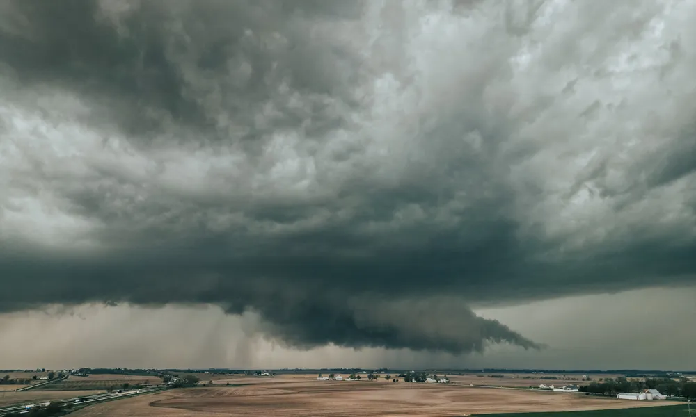
A yellow weather warning for thunderstorms is in force from 11:00 to 23:00 on Friday, as a low-pressure system affects Cyprus, bringing periods of intense weather across the island, particularly in western and southern areas.
Forecasters warn of isolated strong storms, with a risk of hail and shifting, strengthening winds. Rainfall intensity may locally reach between 35 and 55 millimetres per hour.
Authorities are urging the public to exercise caution, noting that conditions may be severe in places and could disrupt daily activities, especially in flood-prone areas.
Stormy conditions expected throughout Friday
Weather conditions are expected to deteriorate gradually during the day, with increasing cloud cover leading to localised showers and isolated thunderstorms, initially in western areas before spreading more widely.
Storms may be intense in some areas, with hail expected and winds becoming variable and stronger. At higher elevations in Troodos, sleet or snowfall is forecast.
Winds will be mainly south-westerly, ranging from light to moderate at 3 to 4 Beaufort, reaching 4 to 5 Beaufort along the coast and locally up to 6 Beaufort in the south-west during the afternoon.
The sea will become slightly rough to rough, and later rough in western areas.
Temperatures will reach around 18°C inland and along most coasts, 17°C in remaining coastal areas, and 8°C in higher mountainous regions.
Overnight conditions remain unstable
Overnight, the weather will remain mostly cloudy with localised rain and isolated thunderstorms. In western and southern areas, conditions may be prolonged or particularly intense.
Hail is again expected in storm conditions, while higher mountainous areas may see sleet or snow. Winds will remain south-westerly to westerly, generally moderate at 4 Beaufort, strengthening to 5 and locally 6 Beaufort along coastal areas.
Sea conditions will range from slightly rough to rough in the north and east, and rough to very rough elsewhere.
Temperatures will drop to around 9°C inland, 10°C on eastern coasts, 12°C on other coasts, and 2°C in higher mountainous areas, where frost may form locally.
Unsettled weather continues into next week
Localised showers and isolated thunderstorms are expected to continue through Saturday, Sunday and Monday, with a continued risk of hail and snowfall or sleet in the higher Troodos peaks.
Temperatures are not expected to change significantly through Monday and will remain slightly below average for the season.